Tehri Dam
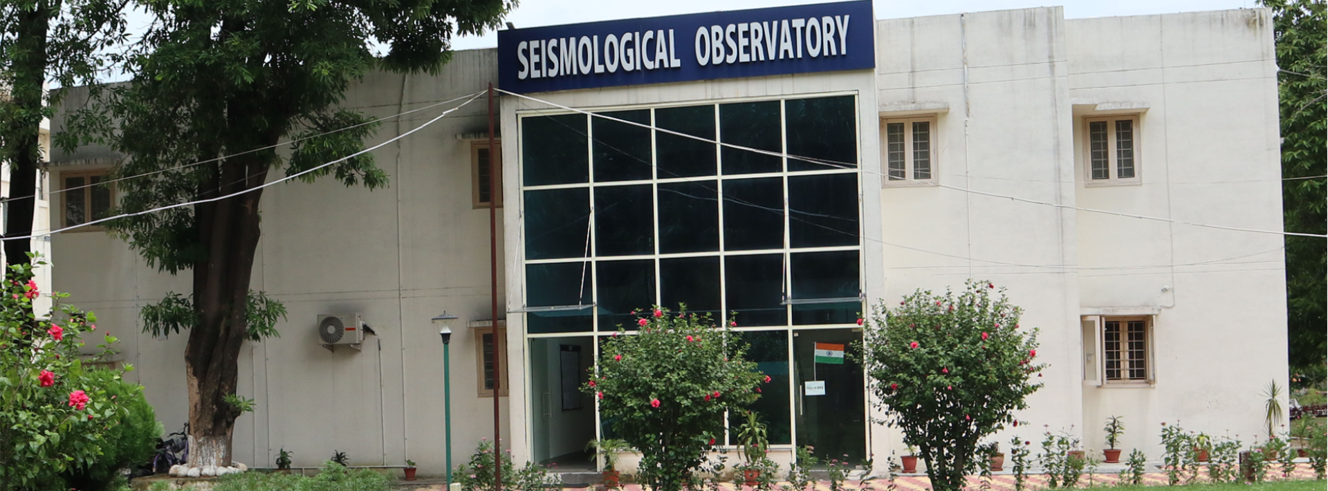
Seismological Observatory
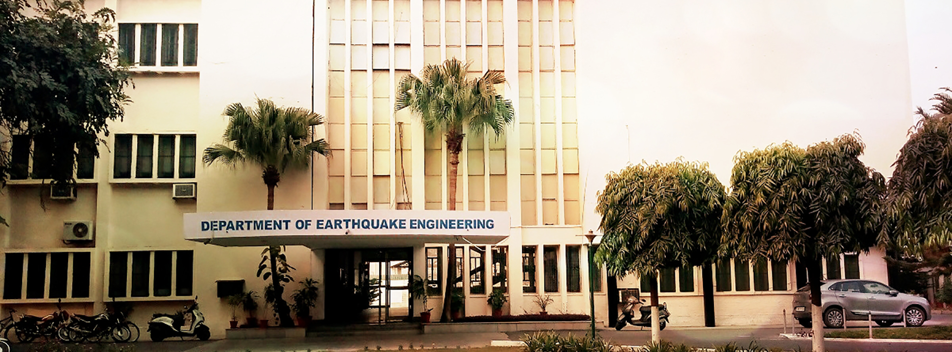
DEQ, IIT
Tehri Dam
THDC INDIA Ltd.
Tehri Dam
Seismological Observatory
DEQ, IIT
Tehri Dam
THDC INDIA Ltd.
Strong Motion instrumentation of dam body is of paramount. Strong Motion instrumentation yields response of the structure and its behaviour during an earthquake. A strong motion instruments network is being operated in Tehri dam, free field and its Power House and Koteshwar dam by THDC. Department of Earthquake Engineering (DEQ), Indian Institute of Technology Roorkee (IITR), is providing guidance as Memorandum Of Understanding (MOU) between the DEQ, IITR and THDC India.
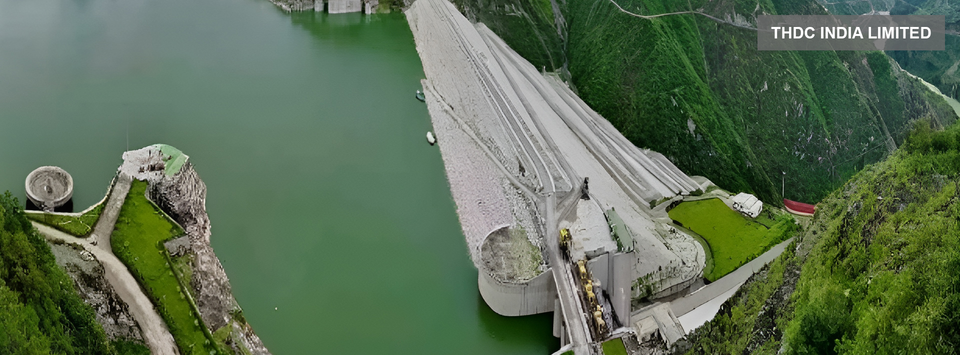
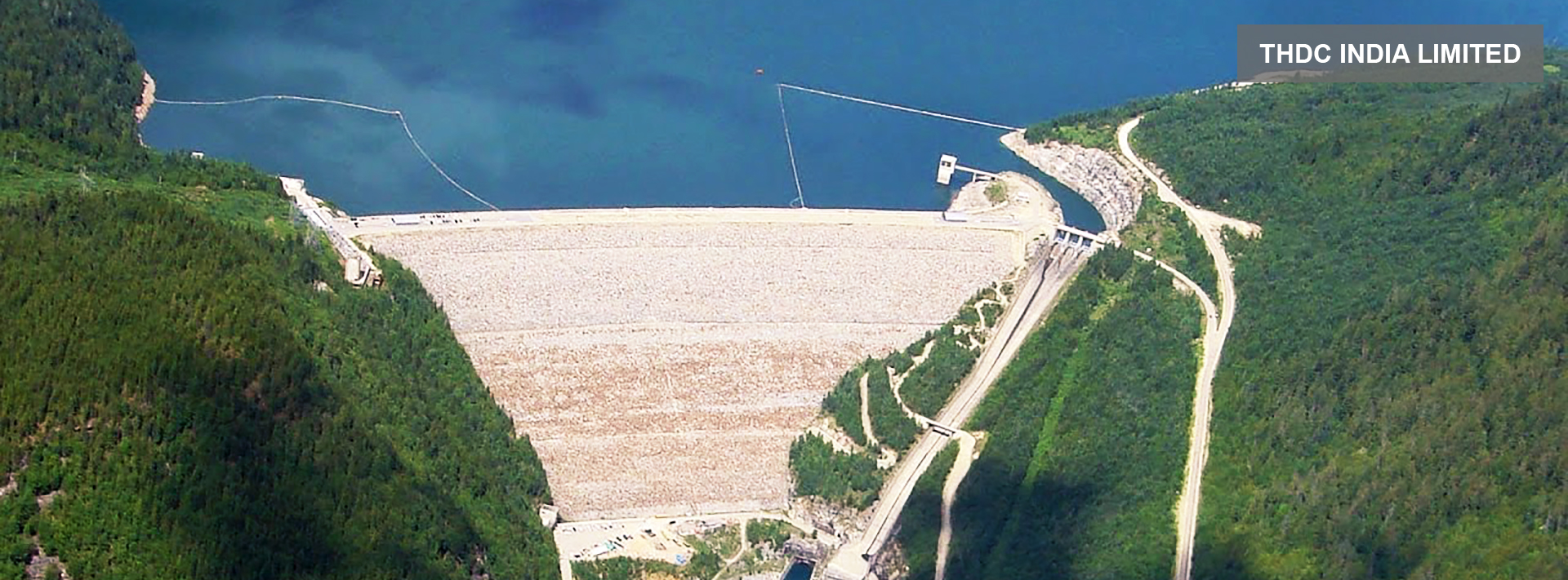
Tehri dam with a height of 260.5 m is the fifth tallest dam in the world. It is located in the Garhwal Kumaon Himalaya of Uttarakhand state of India. It is built down on confluence of Bhagirathi River and Bhilangana River. It is of paramount importance to study the behaviour of dam body during occurrence of earthquake, if it occurs. This can be achieved by deploying the strong motion instrumentation network inside the dam body.
Records of such strong motion instruments installed inside Tehri dam during earthquake will be required for two important purposes:
To calibrate the analytical tools which were used during design phase for seismic analysis of dam. These records are the only way to get the feedback on actual earthquake response of the dam and compare the same as predicted by analytical model. These records will give estimate on deterioration of material properties of dam using system identification and will useful to estimate response of dam during future earthquakes.
These records can also be used to guide the search for possible damages in the dam during an earthquake. Therefore, a strong motion instruments network has been in Tehri dam, Koteshwar dam, Tehri dam power house and free field (near power house) by the THDC India Ltd and operated by DEQ, IITR and is providing guidance within a framework of MOU between DEQ, IITR and THDC India Ltd. All the above instrumentation are connected to Roorkee through BSNL broadband connection for online accessibility of data for speedy and immediate analysis in case of occurrence of any earthquake.
The Seismological Network in Uttarakhand is a vital infrastructure aimed at monitoring and studying seismic activities in the region. Uttarakhand, nestled in the Himalayan foothills, is a seismically active zone prone to earthquakes due to its geological structure and tectonic activities.
The seismological network comprises a system of seismic monitoring stations strategically placed across Uttarakhand. These stations are equipped with seismometers and other specialized instruments capable of detecting even minor seismic movements. The data collected from these stations is analyzed by seismologists to understand the patterns of seismicity, assess earthquake hazards, and provide early warnings to mitigate potential risks.
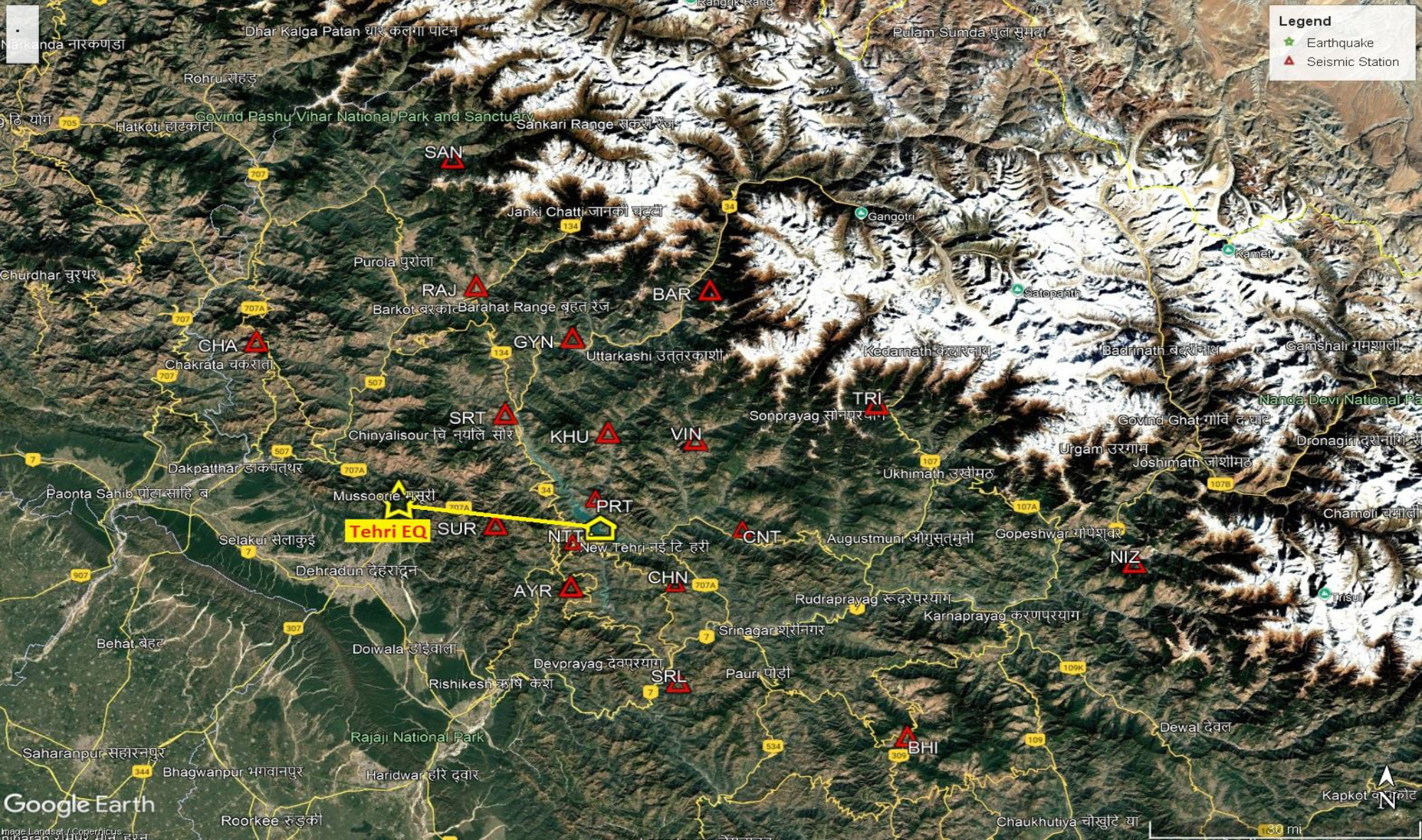
A radio-linked local seismological network around Tehri dam was deployed by the Department of Earthquake Engineering, Indian Institute of Technology Roorkee in July 1995 for the purpose of monitoring local seismicity of the region. Since then the network is continuously operating and recording the local earthquakes in the region. First expansion and upgradation of the network from 6 stations to 12 stations was done in Nov.- Dec. 2007.
In which all the equipment were replaced by the state-of-the-art 24-bits digital telemetry equipment. The second expansion and upgradation of the network from 12 stations to 18 stations has been made recently in July - August 2019. Presently, 18-station seismological network is under operation around Tehri dam reservoir. The locations of stations of the network are selected in such a way that they encompass the area of dam reservoir as well as the active seismic source zones in the region. Analysis and interpretation of local seismological data collected so far has provided valuable information regarding the seismological conditions prevailing in the region around Tehri dam prior, during and after reservoir impounding.
The study of long-term seismological data collected through the operation of local seismological network enable detecting and studying the seismicity changes if any associated with the reservoir impounding for the larger area.
Google Map indicating locations of twenty broadband seismic station (orange ballons: 9 VSAT stations; blue balloons 9 RF Telemetry Stations; red balloons: 2 standalone stations). Click the icon to see further details of each of these stations.
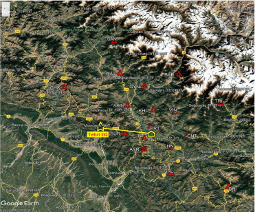
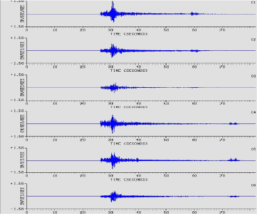
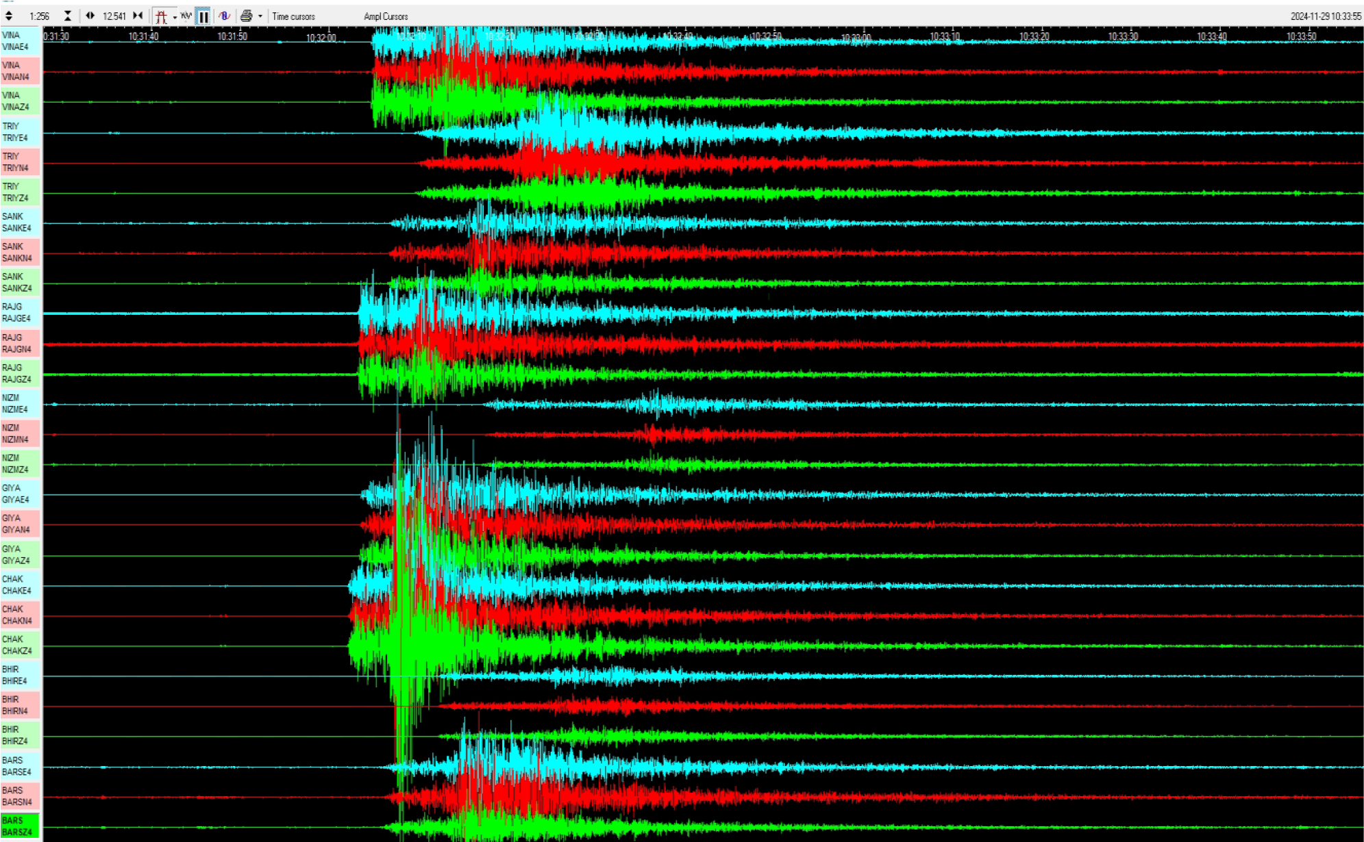
November 29th , 2024 Tehri EQ
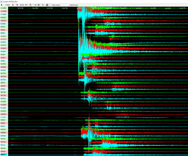
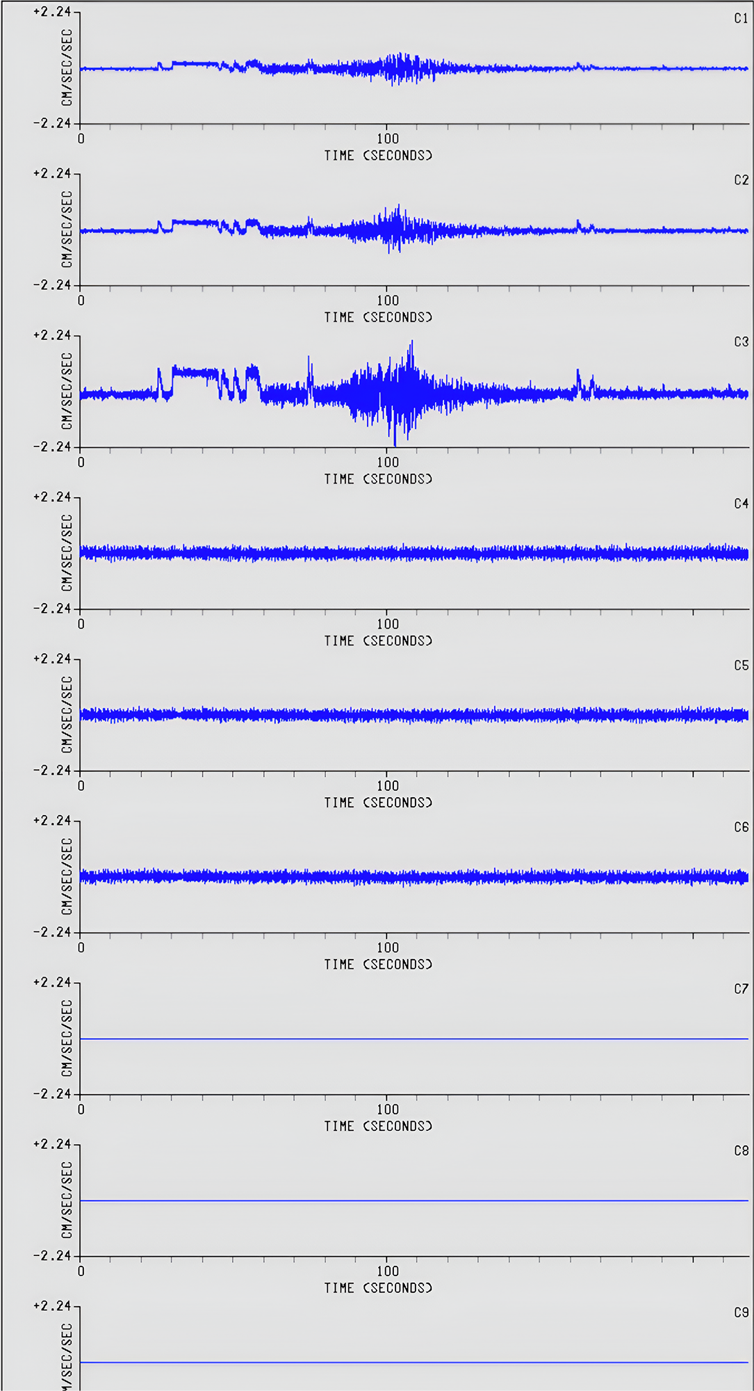
An earthquake of magnitude 3.0 (Ml) occurred about 36 km west of Tehri dam. The magnitude and location of this event is estimated through analysis of the (processed) waveforms recorded by the broadband seismic stations.
Earthquake Parameters |
|
|---|---|
Date: 29.11.2024 |
Origin Time: 16:01:53.6 IST (10:31:53.6 UTC) |
Location: 30.450 ْN 78.111 ْE |
Focal depth: 24.7 km |
Magnitude: 3.0(Ml) |
Distance from Tehri dam: 36 km |
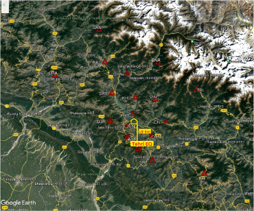
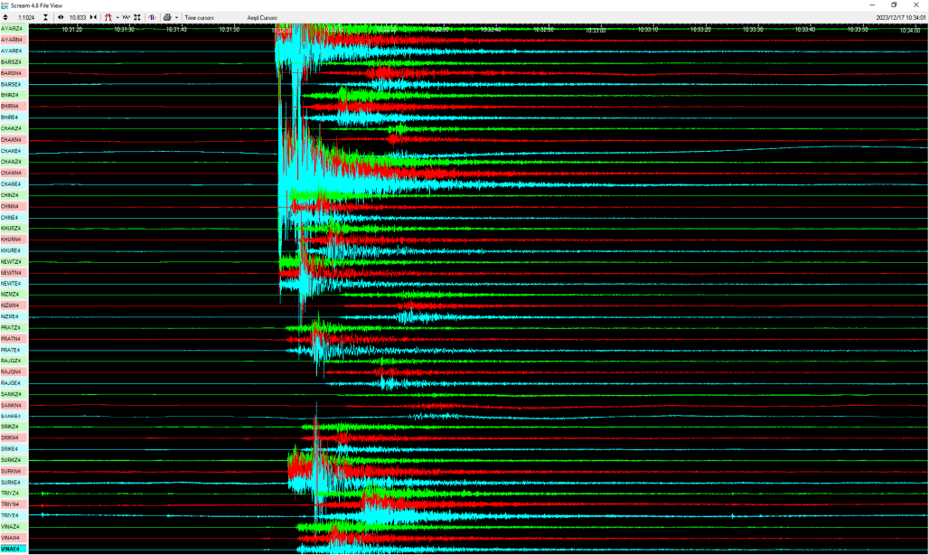
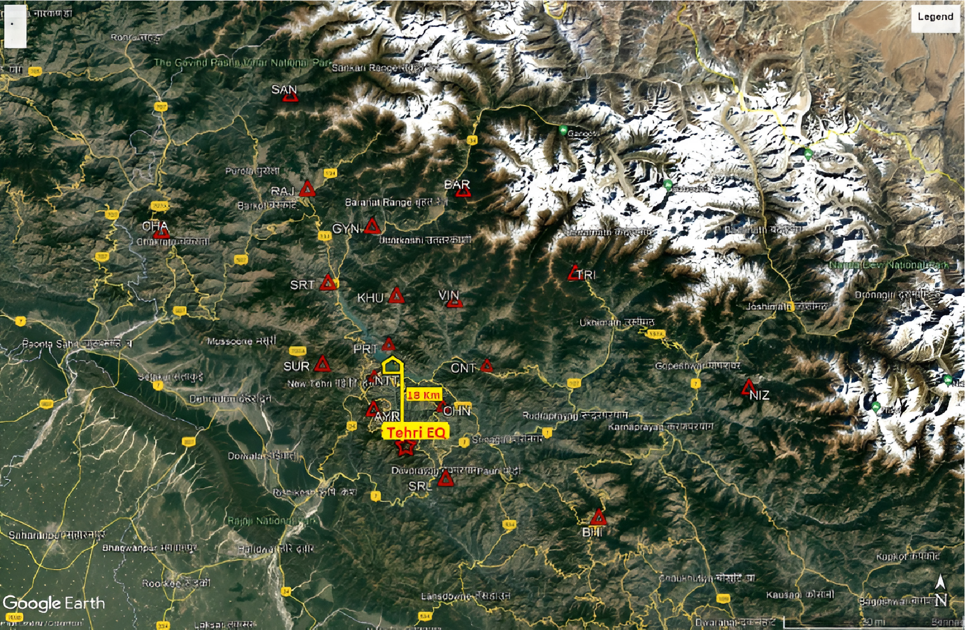
December 17th , 2023 Tehri EQ
An earthquake of magnitude 3.0 (Ml) occurred about 18 km south of Tehri dam and 5 km south from Koteshwar dam. The magnitude and location of this event is estimated through analysis of the (processed) waveforms recorded by the broadband seismic stations.
Earthquake Parameters |
|
|---|---|
Date: 17.12.2023 |
Origin Time: 16:01:52.2 IST (10:31:52.2 UTC) |
Location: 30.214ﹾN 78.521ﹾE |
Focal depth: 24.7 km |
Magnitude: 3.0(Ml) |
Distance from Tehri dam: 18 km |
Distance from Koteshwar dam: 05 km |
|
